ChatGPT:
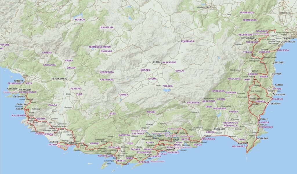
The Lycian Way is a long-distance hiking trail in southwestern Turkey that stretches approximately 540 kilometers (335 miles) along the Mediterranean coast, from Fethiye to Antalya. It is one of Turkey’s most famous trekking routes, known for its stunning scenery, historical significance, and challenging terrain.
Key Features:
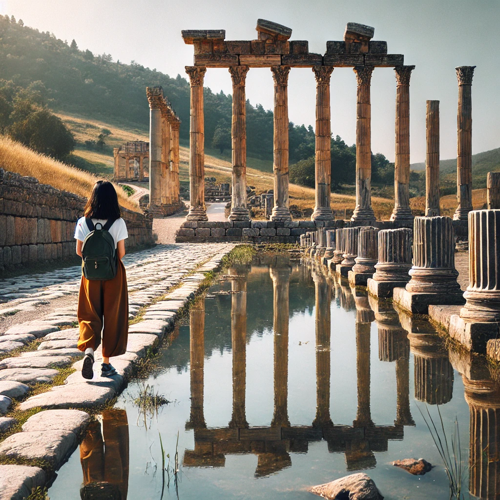
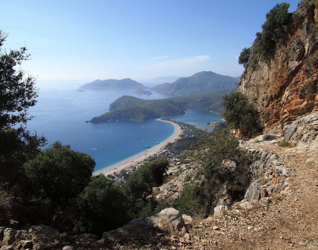
- Scenic Beauty: The trail offers breathtaking views of the Mediterranean Sea, rugged mountains, lush forests, and picturesque coastal villages. It also passes through remote beaches, steep cliffs, and ancient ruins, making it a visually diverse and captivating hike.
- Historical Significance: The Lycian Way is rich in history, passing through the ancient region of Lycia, which was home to the Lycian civilization over 2,000 years ago. Along the way, hikers encounter well-preserved ruins of ancient cities, such as Patara, Xanthos, and Myra, as well as rock-cut tombs and ancient theaters.
- Cultural Experience: The route takes hikers through traditional Turkish villages, where they can experience local hospitality, cuisine, and customs. The trail offers a unique opportunity to connect with the local culture and enjoy the slower pace of life in rural Turkey.
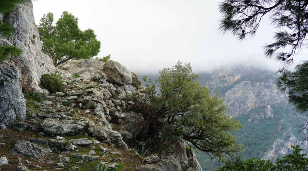
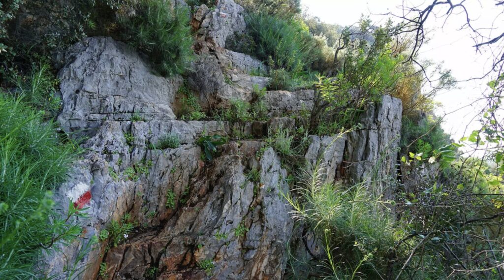
- Challenging Terrain: The Lycian Way is considered moderately difficult, with some sections requiring steep ascents and descents, as well as scrambling over rocky terrain. It is best suited for experienced hikers, though less challenging segments are accessible to casual walkers.
- Variety of Landscapes: The trail offers a mix of coastal walks, mountain paths, and forested tracks. It traverses through diverse ecosystems, including pine forests, olive groves, and river valleys.
- Waymarking: The trail is well-marked with red and white stripes, making it relatively easy to follow. However, due to its length and remote sections, proper preparation, including good maps and possibly a GPS device, is recommended.
- Accommodation: Hikers can stay in pensions, guesthouses, and campsites along the route. Some sections of the trail offer more remote camping opportunities, allowing for a deeper connection with nature.
Best Time to Hike:
The best time to hike the Lycian Way is in the spring (April to June) or autumn (September to November) when the weather is mild and the landscapes are lush and vibrant. Summer can be extremely hot, especially in the more exposed coastal sections, making the hike more challenging.
The Lycian Way offers an unforgettable adventure for those seeking to explore Turkey’s natural beauty and ancient history on foot.
The Lycian civilization thrived in the region known as Lycia, located in what is now southwestern Turkey, along the Mediterranean coast. It was an ancient Anatolian culture that existed from around 2000 BCE until it was fully absorbed into the Roman Empire in the 1st century BCE.
Key Characteristics:
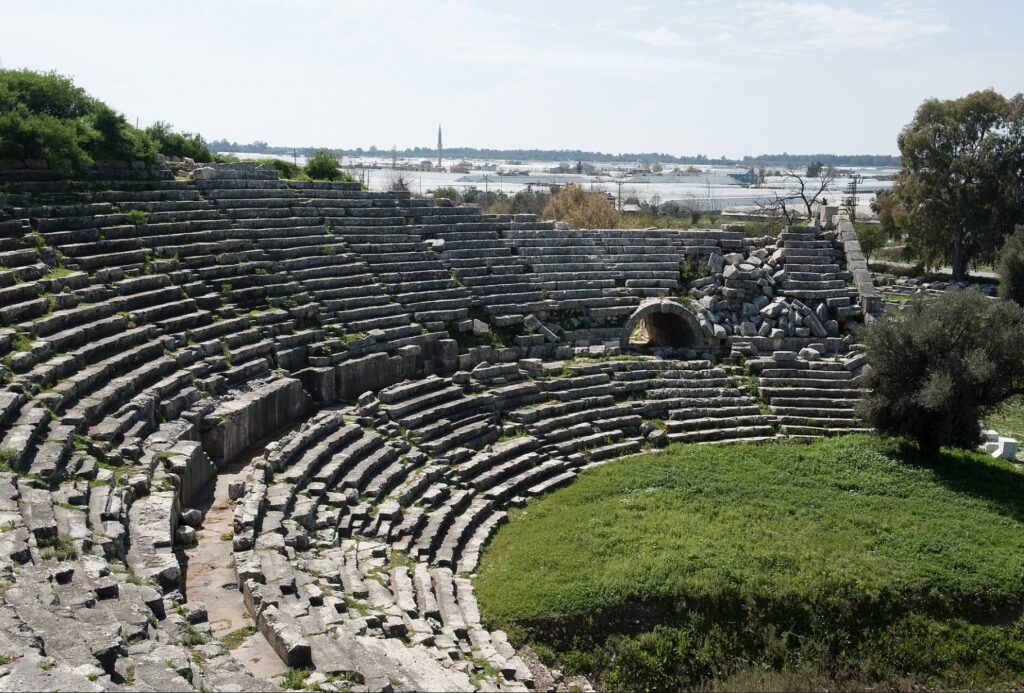
- Geography and Cities: Lycia was a mountainous region with a rugged coastline. The Lycians built numerous city-states, often located on hilltops for defense. Prominent cities included Xanthos, Patara, Myra, and Tlos.
- Political Structure: Unlike other ancient civilizations, Lycia was known for its unique confederation of city-states, each of which had a certain degree of autonomy. These city-states were united in a league, with representatives meeting at a central assembly.
- Language and Writing: The Lycians spoke their own language, which is part of the Luwian branch of the Anatolian languages. They used a distinctive script for writing, which has been partially deciphered.
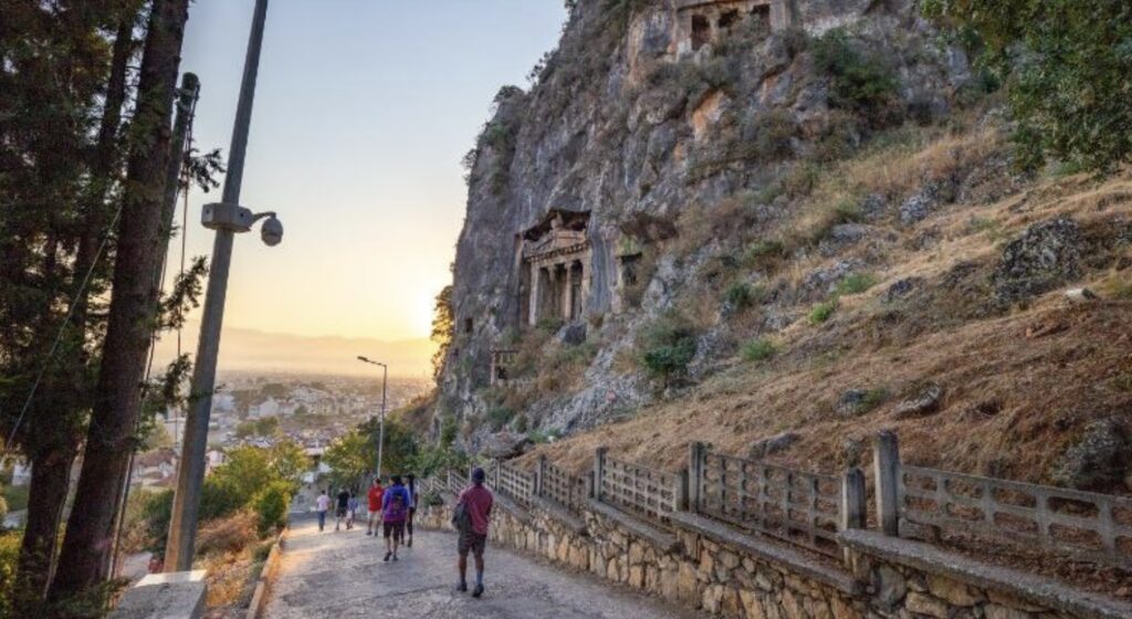
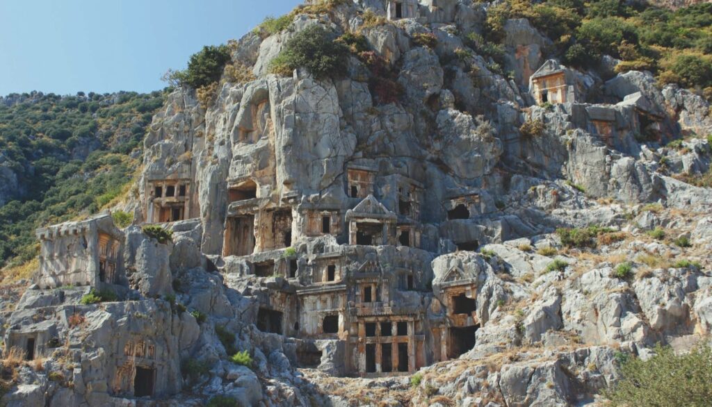
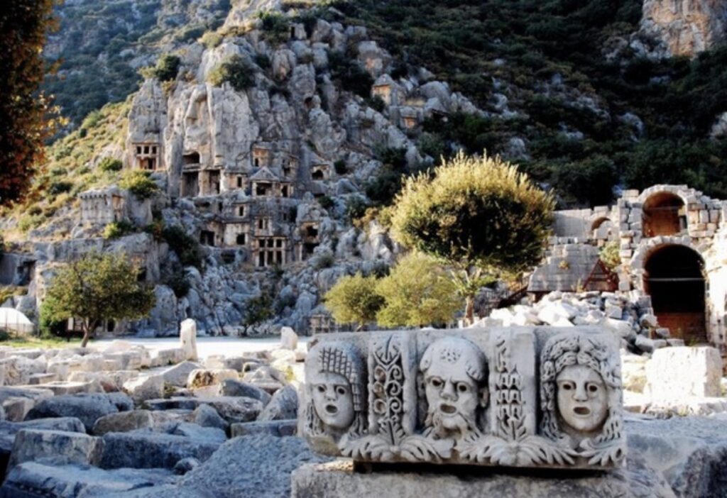
- Architecture: Lycian architecture is noted for its rock-cut tombs, often carved into cliffs, which are among the most iconic remnants of their civilization. These tombs often feature elaborate facades that resemble wooden houses or temples.
- Religion: The Lycians practiced a polytheistic religion, with influences from both Greek and indigenous Anatolian deities. The most prominent Lycian deity was likely the sun god, often associated with Apollo.
- Conquests and Influence: Lycia was initially influenced by the Hittites and later came under the control of the Persian Empire. It eventually became a part of the Hellenistic world following Alexander the Great’s conquest. Finally, Lycia was absorbed into the Roman Empire, which led to the decline of its distinct culture.
The Lycian civilization is remembered for its rich cultural heritage, particularly its distinctive funerary architecture, and its strategic position along ancient trade routes.
The Lycian Way is rich in historical monuments and tourist attractions, many of which are remnants of the ancient Lycian civilization. Here’s a list of some of the most notable sites along the trail:
Historical Monuments:
- Xanthos (Kınık):
- An ancient Lycian capital and UNESCO World Heritage site.
- Features include the Xanthian Obelisk, the Harpy Tomb, and an ancient theater.
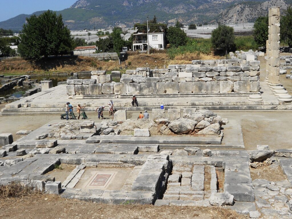
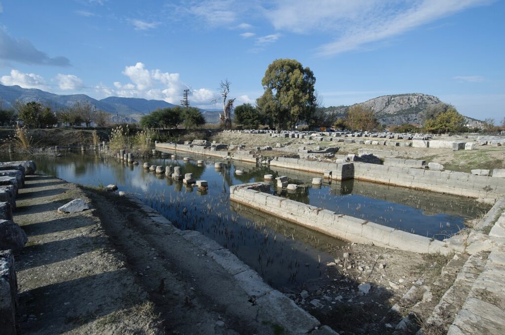
- Letoon (near Xanthos):
- Another UNESCO World Heritage site.
- Was a major religious center with temples dedicated to Leto, Apollo, and Artemis.
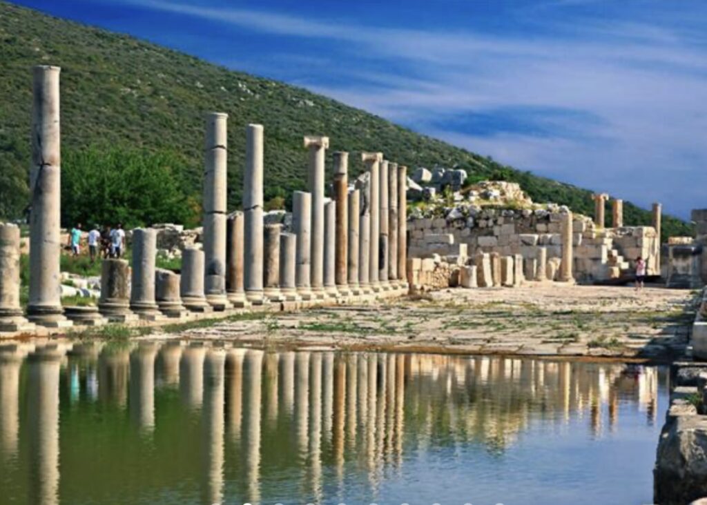
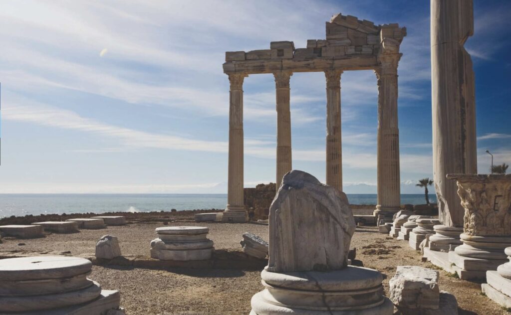
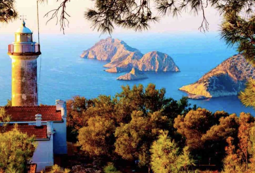
- Patara:
- An important Lycian city and the birthplace of St. Nicholas.
- Highlights include the ancient theater, the triumphal arch, and the oldest lighthouse in the world.

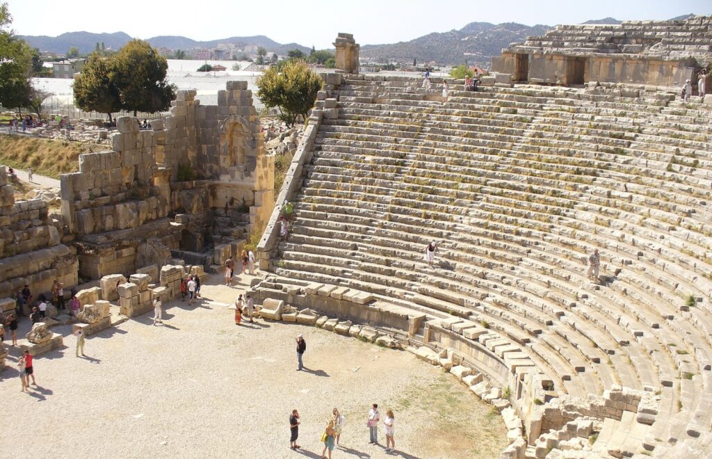
- Myra (Demre):
- Known for its rock-cut tombs and large amphitheater.
- Also the location of the Church of St. Nicholas, who later became known as Santa Claus.
- Olympos:
- An ancient city located in a valley near the coast.
- Famous for its ruins scattered in a forest and the nearby Chimaera (Yanartaş), a natural eternal flame burning from the rocks.
- Phaselis:
- An ancient harbor city with well-preserved ruins.
- Notable for its Roman aqueduct, three harbors, and the remains of baths, theaters, and city walls.
- Arycanda:
- An ancient Lycian city known for its well-preserved ruins, including a theater, stadium, baths, and necropolis.
- Tlos:
- One of the oldest and most important cities in Lycia.
- Features include a fortress, an acropolis, rock-cut tombs, and a large Roman theater.
Tourist Attractions:
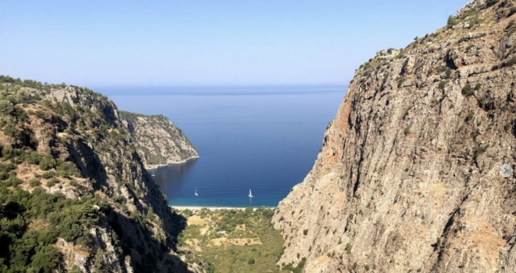
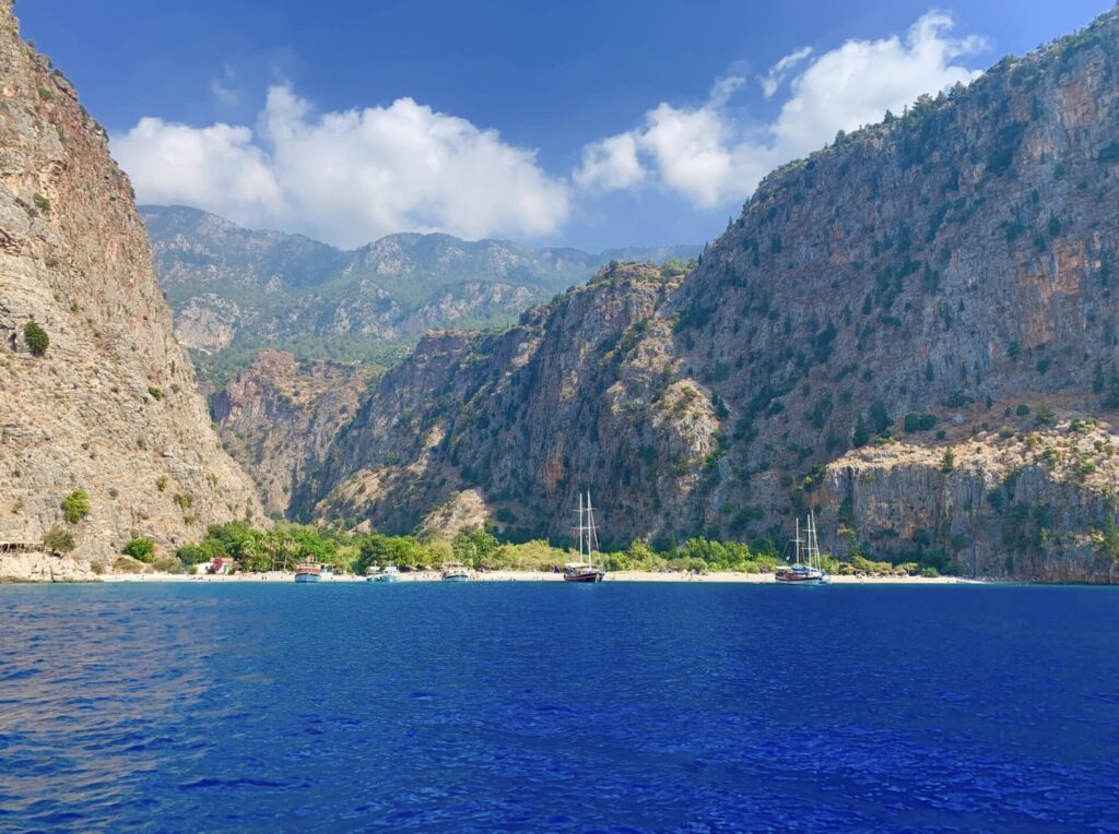
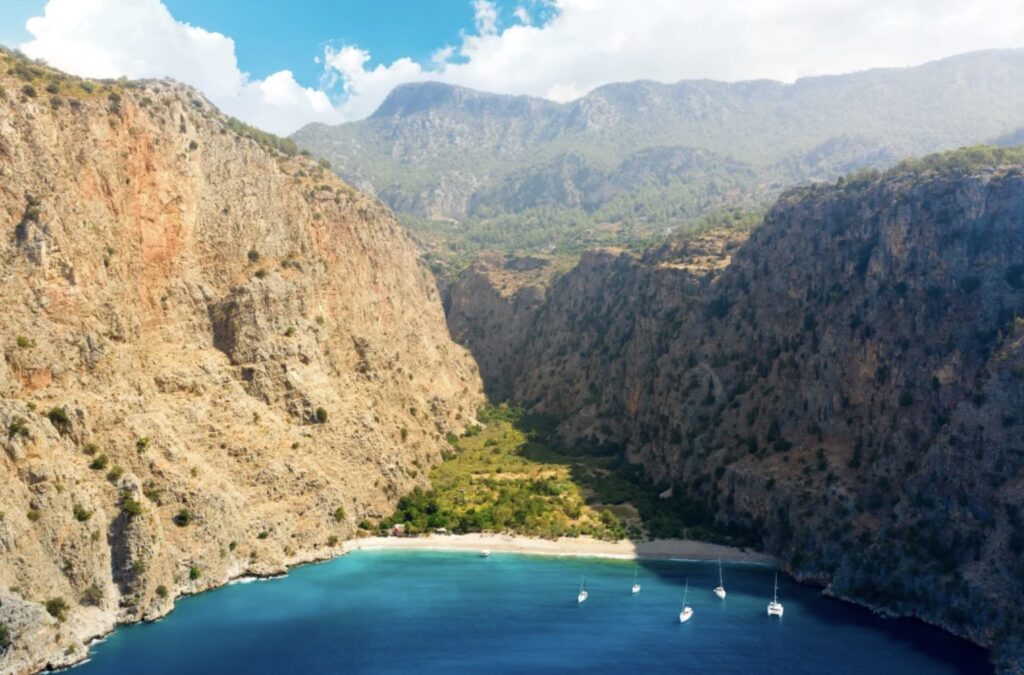
- Butterfly Valley (Kelebekler Vadisi):
- A stunning natural gorge that can be accessed by a challenging hike or by boat.
- Known for its pristine beach and the variety of butterflies found there.
- Kabak Bay:
- A beautiful, secluded bay ideal for relaxation and swimming.
- Popular with hikers looking for a tranquil retreat.
- Saklıkent Gorge:
- One of the deepest gorges in Turkey.
- Offers opportunities for hiking through the gorge and experiencing its cool waters.
- Kekova Island and Sunken City:
- An island near the town of Demre with underwater ruins visible from the surface.
- Popular for boat tours and snorkeling.
- Kaleköy (Simena):
- A picturesque village accessible only by boat or on foot.
- Features a Byzantine castle with stunning views over the Mediterranean.
- Mount Olympos (Tahtalı Dağı):
- A mountain offering panoramic views of the surrounding region.
- Accessible by hiking or via a cable car ride to the summit.
- Çıralı Beach:
- A serene beach near the ancient city of Olympos.
- Also known for its proximity to the Chimaera, where natural flames emerge from the ground.
- Göynük Canyon:
- A scenic canyon with opportunities for canyoning, swimming, and hiking.
- Located near the village of Göynük.
These sites along the Lycian Way offer a unique blend of natural beauty and ancient history, making the trail a rich and diverse experience for hikers and history enthusiasts alike.
The Lycian Way can be divided into various sections based on the difficulty of physical activity required. Here’s a general classification into easy, moderate, and challenging sections:
Easy Sections:
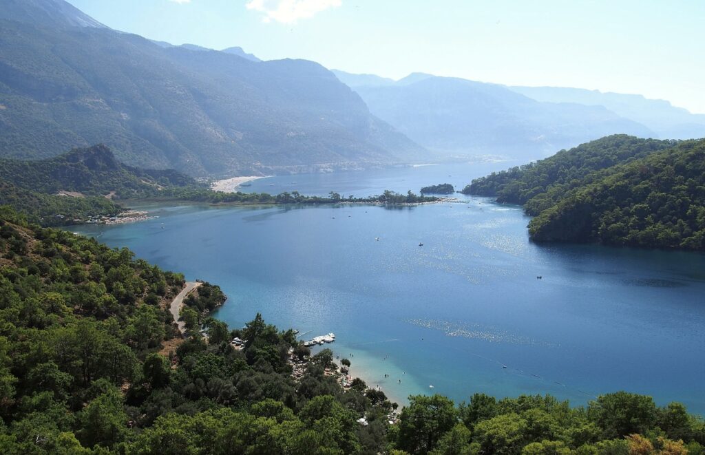
- Ölüdeniz to Faralya (Butterfly Valley):
- Distance: ~13 km
- Highlights: Stunning views of Ölüdeniz Lagoon and Butterfly Valley.
- Description: A relatively short and well-trodden path with gradual ascents, making it accessible for most hikers.
- Patara to Kalkan:
- Distance: ~15 km
- Highlights: Ancient ruins of Patara and scenic coastal views.
- Description: A straightforward route with mostly flat terrain, suitable for beginners.
- Çıralı to Olympos:
- Distance: ~5 km
- Highlights: Çıralı Beach, the ancient city of Olympos, and the Chimaera.
- Description: A short and easy walk through coastal paths, passing through forests and ancient ruins.
Moderate Sections:
- Faralya to Kabak:
- Distance: ~9 km
- Highlights: Spectacular coastal views, remote beaches.
- Description: A slightly more demanding hike with some steep sections, but manageable for most hikers.
- Kalkan to Kaş:
- Distance: ~20 km
- Highlights: Beautiful coastal scenery, Lycian ruins.
- Description: A longer day hike with rolling hills and a few steeper ascents, but generally moderate.
- Demre to Myra:
- Distance: ~15 km
- Highlights: Rock-cut tombs, ancient ruins.
- Description: A moderate hike with varied terrain, including some uphill sections.
- Kaş to Kılınçlı (Apollonia):
- Distance: ~15 km
- Highlights: Lycian ruins, sea views.
- Description: Some ascents and descents but nothing too strenuous.
Challenging Sections:
- Göynük Canyon to Hisarçandır:
- Distance: ~27 km
- Highlights: Scenic canyon, forested paths.
- Description: A challenging section with steep ascents and descents, requiring good fitness and stamina.
- Alınca to Gey (via Sidyma):
- Distance: ~18 km
- Highlights: High altitude paths, remote ruins.
- Description: This section involves significant elevation changes and some rough terrain, making it challenging.
- Karaöz to Adrasan:
- Distance: ~16 km
- Highlights: Coastal views, rugged landscapes.
- Description: Steep ascents and rocky paths make this a demanding hike, suitable for experienced hikers.
- Adrasan to Çıralı (Mount Olympos):
- Distance: ~19 km
- Highlights: Mount Olympos, panoramic views.
- Description: A strenuous section with a tough climb over Mount Olympos, requiring good endurance.
- Bel to Kızılca:
- Distance: ~24 km
- Highlights: Mountainous terrain, remote villages.
- Description: A long, difficult trek with significant elevation gain, best for well-prepared hikers.
Summary:
- Easy: Ölüdeniz to Faralya, Patara to Kalkan, Çıralı to Olympos.
- Moderate: Faralya to Kabak, Kalkan to Kaş, Demre to Myra, Kaş to Kılınçlı.
- Challenging: Göynük Canyon to Hisarçandır, Alınca to Gey, Karaöz to Adrasan, Adrasan to Çıralı, Bel to Kızılca.
This classification can vary based on individual fitness levels, experience, and weather conditions, so it’s important to prepare accordingly and assess each section before starting the hike.
Finding accommodation and food supplies along the Lycian Way is generally manageable, but the ease of access varies depending on the section of the trail you’re hiking. Here’s a breakdown:
Accommodation:
- Villages and Towns: The Lycian Way passes through numerous villages and small towns where you can find pensions, guesthouses, and small hotels. Places like Fethiye, Ölüdeniz, Faralya, Kabak, Kaş, Kalkan, Demre, and Çıralı have a range of accommodations that cater to hikers.
- Remote Sections: In more remote parts of the trail, especially in the mountainous or less populated areas, accommodation options can be sparse. In these sections, camping may be the best or only option. Some villages may offer basic guesthouses or homestays, but it’s advisable to plan ahead.
- Camping: If you prefer camping, there are many spots along the trail where you can pitch a tent. In more developed areas, you might find organized campsites, while in remote areas, wild camping is possible, but be sure to follow local guidelines and respect nature.
Food Supplies:
- Towns and Villages: In towns and larger villages, you’ll find grocery stores, markets, and local shops where you can buy food supplies. Many guesthouses and pensions also offer meals or packed lunches for hikers.
- Restaurants and Cafés: Along the trail, especially near tourist areas and coastal sections, there are restaurants and cafés where you can have a meal. These places often serve traditional Turkish food, which is hearty and suitable for the energy needs of hikers.
- Remote Sections: In more isolated sections of the Lycian Way, food supplies can be limited. It’s important to stock up on essentials when you pass through towns and larger villages. Carrying some non-perishable snacks, like nuts, dried fruits, and energy bars, is advisable for these stretches.
Tips for Planning:
- Plan Ahead: Research your route and identify where you’ll be able to find accommodation and food. Some guidebooks and websites offer detailed information on where to find these services along the trail.
- Carry Essentials: Even if you’re staying in guesthouses, it’s a good idea to carry some basic supplies, especially water, as water sources can be scarce in certain sections.
- Local Assistance: Don’t hesitate to ask locals for recommendations on where to stay or buy food. Turkish hospitality is renowned, and locals are often willing to help hikers.
Summary:
While it is relatively easy to find accommodation and food supplies in more populated and tourist-friendly sections of the Lycian Way, remote sections require more careful planning. Stock up when you have the chance, and be prepared for some basic camping and self-catering in the less accessible areas.