ChatGPT:
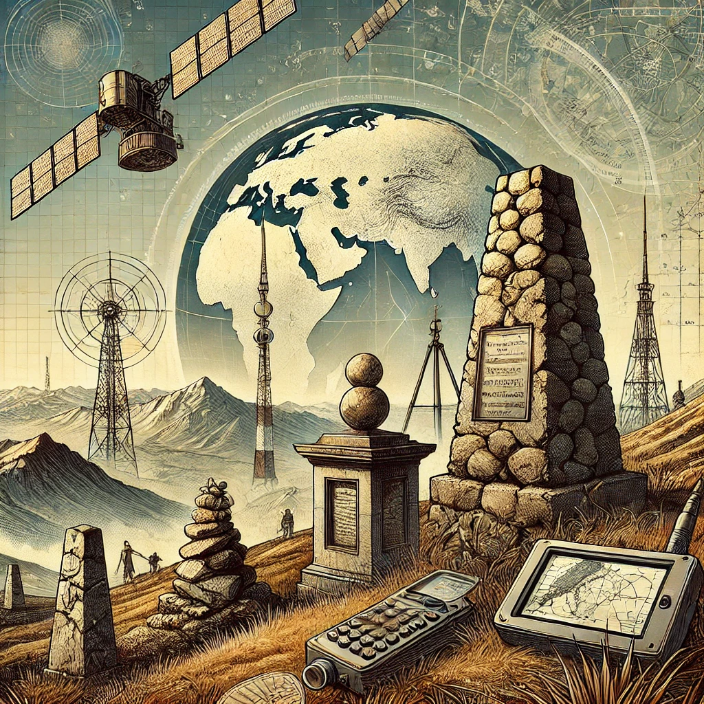
Geodesy is the scientific discipline that studies the shape, size, and structure of the Earth, as well as its gravitational field and how these change over time. It plays a critical role in understanding Earth’s physical properties and provides the foundation for mapping, navigation, and Earth observation systems.
Key Objectives of Geodesy
1. Measuring Earth’s Shape and Size:
Geodesy aims to determine Earth’s geometric shape, which is not a perfect sphere but an oblate spheroid (slightly flattened at the poles and bulging at the equator). Advanced measurements reveal that Earth’s surface also has irregularities due to mountains, valleys, and variations in density.
2. Determining Earth’s Position in Space:
Geodesy tracks Earth’s orientation in space over time, accounting for phenomena like the precession of the Earth’s axis, tectonic plate movements, and polar motion.
3. Studying Earth’s Gravity Field:
It examines Earth’s gravitational field, which varies based on the planet’s mass distribution. This information is crucial for understanding sea level, tides, and satellite orbits.
4. Monitoring Changes Over Time:
Geodesy studies changes in Earth’s shape, gravity field, and rotation due to tectonic activity, glacial melting, and other dynamic processes.
Applications of Geodesy
1. Mapping and Cartography:
Provides the precise coordinates and reference systems needed to create accurate maps.
2. Navigation and Positioning:
Supports Global Navigation Satellite Systems (GNSS) like GPS, essential for modern transportation, agriculture, and urban planning.
3. Earth Observation and Climate Monitoring:
Tracks changes in ice sheets, sea levels, and land deformation, contributing to the study of climate change and natural disasters.
4. Infrastructure Development:
Ensures the accuracy of construction projects, such as tunnels, bridges, and dams, by providing reliable geodetic data.
Methods and Tools
1. Triangulation:
A historical method that measures angles in a series of connected triangles to determine distances and positions.
2. Satellite Geodesy:
Modern satellites measure Earth’s shape and gravity field with unprecedented accuracy, using systems like GRACE (Gravity Recovery and Climate Experiment) and GNSS.
3. Very Long Baseline Interferometry (VLBI):
Tracks Earth’s orientation in space by observing distant celestial objects like quasars.
4. Geodetic Surveys:
Ground-based measurements using tools like theodolites, total stations, and LiDAR systems for local precision.
Importance of Geodesy
Geodesy is fundamental to understanding our planet’s physical properties, supporting critical systems like weather forecasting, earthquake monitoring, and space exploration. Its integration with modern technologies has made it indispensable for both scientific research and everyday applications.

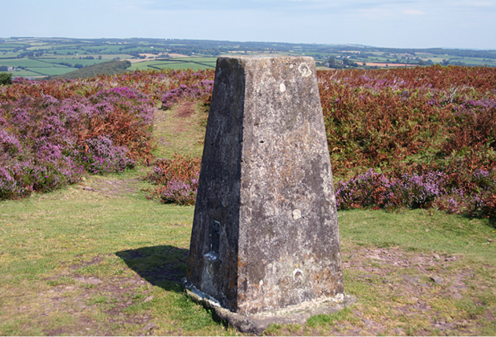
In the United Kingdom, the equivalent of the Struve Geodetic Arc’s function can be seen in the Ordnance Survey Triangulation Points, commonly known as Trig Points or Triangulation Pillars. These markers were established primarily for mapping and geodetic purposes.
Key Characteristics of UK Trig Points
1. Purpose:
• Used for the Retriangulation of Great Britain (1936–1962), these points helped create an accurate national map of the UK.
• They provided fixed reference points for surveying and mapping using triangulation techniques.
2. Physical Description:
• Typically, a concrete pillar about 4 feet tall, with a brass plate or mounting on top for attaching a theodolite.
• Many are located on hilltops or other high ground to ensure line-of-sight visibility between triangulation points.
3. Distribution:
• Over 6,500 trig points were erected across the UK, though many are no longer in active use due to advancements in satellite-based geodesy like GPS.
Examples of Famous Trig Points in the UK
1. Kinder Scout Trig Point (Peak District):
Located on the highest point in the Peak District, this trig point is a popular spot for hikers.
2. Ben Nevis Trig Point (Scotland):
Found at the summit of Ben Nevis, the highest mountain in the British Isles.
3. Scafell Pike Trig Point (Lake District):
Situated on England’s tallest mountain, marking a historic surveying station.
4. Snowdon Trig Point (Wales):
Located at the peak of Mount Snowdon, it serves as a key geographical marker.
5. Hampstead Heath Trig Point (London):
A trig point in an urban setting, used in the past for mapping parts of the city.
Modern Relevance
While many trig points remain as historical landmarks, their geodetic function has largely been replaced by satellite technologies such as Global Navigation Satellite Systems (GNSS). However, they still hold cultural and historical significance and are popular among hikers and geocaching enthusiasts. Some trig points also serve as local surveying reference points.
Many countries have geodetic markers similar to the UK’s Trig Points, which were historically used for surveying, mapping, and geodetic purposes. These markers vary in design and purpose but serve similar functions. Here are examples from around the world:
Europe
1. France – Borne Géodésique:
• France has geodetic markers used by the Institut Géographique National (IGN) for mapping. These include metal plaques or concrete pillars placed at key surveying points.
2. Spain – Vértices Geodésicos:
• Spain has a network of geodetic vertices, often found on mountains and strategic high points. These markers were part of national mapping efforts.
3. Germany – Geodätischer Punkt:
• Germany’s geodetic points are part of a precise national and European surveying network, marked by plaques or monuments.
4. Nordic Countries – Trigonometric Stations:
• Norway, Sweden, and Finland maintain systems of geodetic points similar to trig points, used historically for mapping and now integrated with modern GNSS networks.
Asia
1. India – Great Trigonometrical Survey (GTS) Stations:
• Established during the British colonial era, the GTS marks were used to create a highly accurate map of India. Mount Everest was first identified as the world’s tallest peak through this survey.
2. Japan – Survey Markers:
• Japan has a network of triangulation points used for mapping and monitoring tectonic activity, often marked by plaques or small monuments.
North America
1. United States – Survey Monuments:
• The U.S. has over a million survey monuments, often brass or aluminum disks embedded in concrete or bedrock, established by the National Geodetic Survey (NGS). Many are still used for modern surveying.
2. Canada – Geodetic Benchmarks:
• Similar to the U.S., Canada uses geodetic markers for land surveys and mapping, maintained by the Canadian Geodetic Survey.
South America
1. Brazil – Marco Geodésico:
• Brazil’s geodetic markers are part of a nationwide network managed by the Brazilian Institute of Geography and Statistics (IBGE).
2. Argentina – Triangulation Points:
• Argentina has markers for mapping and land surveying, often placed in rural and highland areas.
Africa
1. South Africa – Trig Beacons:
• South Africa has trig beacons, steel structures on concrete bases, used for national mapping. They are often found on mountain tops and remain popular with hikers.
2. Egypt – Geodetic Points:
• Established during historical surveys, these points have been integrated into modern systems for land management and navigation.
Australia and Oceania
1. Australia – Survey Control Marks:
• Australia has Geodetic Survey Marks, typically concrete pillars with brass plates or embedded disks. They were integral to mapping the vast country and remain in use for local surveying.
2. New Zealand – Trig Stations:
• New Zealand’s trig stations are prominent on ridges and peaks, marked by white wooden structures or metal poles. They are still visible landmarks and often used by hikers.
Modern Use
While most of these markers have been supplanted by satellite geodesy (e.g., GPS, GNSS), many still serve as:
• Reference points for local surveys.
• Cultural landmarks, especially for hikers.
• Backup systems for geodetic networks.
These geodetic markers highlight a shared global effort in understanding and mapping the Earth with precision.
Triangulation is a method used in surveying and geodesy to measure distances and map locations by forming triangles between known points. It relies on the mathematical principle that if one side of a triangle and the angles at both ends are known, the other two sides and the entire triangle can be calculated.
How Triangulation Works
1. Establish a Baseline:
A straight line of a precisely measured distance is selected as the baseline. This serves as the foundation for calculations.
2. Measure Angles:
Using instruments like a theodolite, surveyors measure the angles between the baseline and two distant points (often marked by physical features like mountains, towers, or triangulation pillars).
3. Calculate Distances:
By applying trigonometric formulas (laws of sines and cosines), the lengths of the other two sides of the triangle are determined. These calculations allow the surveyors to establish the positions of the distant points relative to the baseline.
4. Expand the Network:
Once one triangle is measured, its sides can become baselines for further triangles, creating a network of interconnected triangles over a wide area.
Triangulation Formula Example
Using the law of sines:
Where:
• are the sides of the triangle.
• are the opposite angles.
If the baseline () and two angles ( and ) are known, the other sides () can be calculated.
Examples of Triangulation
1. Historical Example: The Struve Geodetic Arc
• A 19th-century network of 258 triangles stretching over 2,800 km was used to measure Earth’s meridian arc and determine its shape.
2. Modern Example: GPS (Global Positioning System)
• While satellites use a method closer to trilateration, triangulation principles are still applied to calculate positions by measuring angles between multiple satellite signals.
3. Coastal Mapping:
• Triangulation has been widely used for mapping coastlines, with surveyors measuring angles from fixed stations onshore to distant points at sea.
4. Measuring Tall Objects:
• To calculate the height of a mountain or building, surveyors use triangulation by observing angles from two separate points with a known baseline.
Advantages of Triangulation
• High Accuracy: Precise instruments and calculations make it reliable over long distances.
• Scalability: A small, measured baseline can be extended to cover vast areas using a network of triangles.
• Cost-Effective: Historically, it required fewer tools and resources compared to directly measuring long distances.
Limitations
• Terrain Constraints: Requires clear visibility between points, making it challenging in dense forests or urban areas.
• Weather Dependence: Atmospheric conditions can affect measurements.
• Complex Setup: Accurate baselines and well-placed observation stations are critical.
Modern Relevance
Although triangulation has been largely replaced by satellite geodesy and GNSS, it remains fundamental in local surveying, backup methods, and educational settings. It was foundational in early geodesy projects, such as the Struve Geodetic Arc and the Great Trigonometric Survey of India.